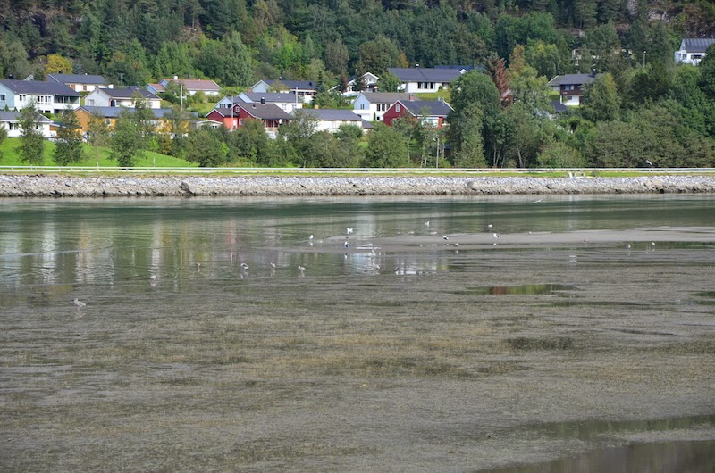
Well this is it, the moment of truth. The weather was good this morning, so we decided to go on the infamous Romsdalseggen hike/climb! We were going to ascend > 1000metres and descend 1400 metres. To put that in perspective, the empire state building including the tip is 443.2 metres high, and the observatory is a mere 373 metres. To say it's high, well that's an understatement.
7:30am Woke up, and we checked the weather. Sunny in the morning, and that was good enough for us. We purchased the tickets from the owners of the hostel, which was 135 norwegian crowns each, that's for the bus which takes you to the Vengedalen valley, and from there, you start the hike. We had breakfast, packed (3 litres of fluid, bread, SLR camera, and plenty of adrenaline), and then we were off at around 8:45am or so, since it takes us about half an hour to get to the bus terminal which is the same area where you catch the train.
10am or so, arrived at Vengedalen which is about 300m above sea level.

:)

Where it all begins!

Awesome!

Mud. Lots of it. It rained the day before which made it quite a pain going up.

Awesome!

Bridge with waterfall

Spot the people!
10:41am Already sweating like a pig at this point. But we persevered. Took a short 10 minute or so break at this point.

I'm smiling because I'm still alive!

Always follow the rocks marked in red.

The group of people that you see in the distance were a group of Norwegians, it was an organised hike from the tour office.

It was slowly becoming foggy at this point.

We picked the Høgnøsa route, which is longer, and supposedly "easier" (but turned out, not really).
So on the bus the driver said that if it becomes foggy or rainy, the Høgnøsa route is supposedly better. So that was what we picked. The weather was changing quickly at this point.

Nothing to see here... but fog now, but we're not going that way.
11:44am

The path ahead. Pretty amazing huh?

We even spotted a tiny hut! That's our pit stop for lunch.

It even has beds. And that's my bag.
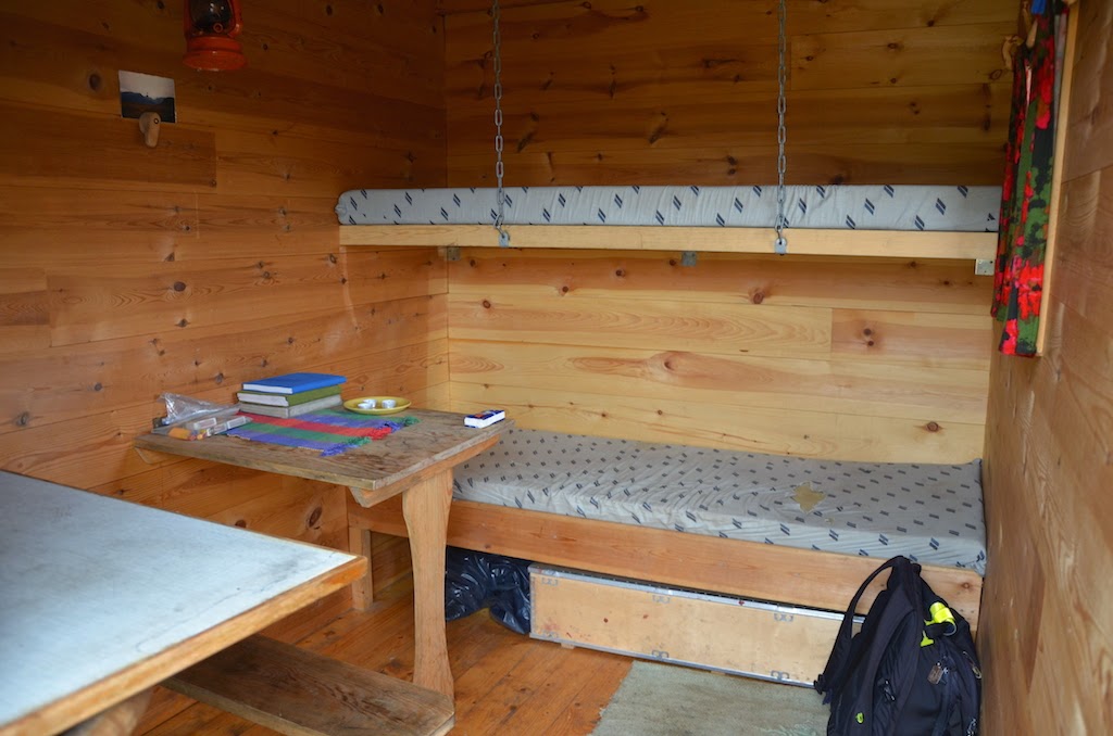

Cooking materials.

For emergencies I suppose. It's pretty handy to have a hut on top of a mountain in the middle of nowhere.

Lunch surroundings...

Lunch surroundings...

Lunch was bread with cheese and ham, plus my SLR camera (and yes I was crazy enough to bring it with me)
12:41pm Time to resume. My pear brus cap broke at this point and so I had leaked soda all over my pants, annoying but I'll live.

A small lake, we had to walk on the rocks over to the other side which was tricky at times because the water made the surface slippery.

Isn't it surreal??

Mountain sheep! There were quite a few of them.

More sheep.

Blueberries! They didn't taste very good though.
1:06pm Here we go uphill again...

Time to go up...

Can you see the town in the background?

Up we go now.

Reaching the marker...
More vigorous climbing which was at this stage, complete rocks. I pretty much put my camera away because I had to fully use my hands.
1:47pm We reached the top of Høgnøsa. A full 838 metres above sea level.

Are we at the top now??
At this stage I thought we were at the top, but no, there was a lot more climbing to do!

See the ridge? Yeaah.. we're going to walk on that...
By this stage I was not only exhausted I was quite scared because it was starting to rain and damn I didn't know we were going to on the ridge if we took the "easier" route.

This was what we basically went through, going through nothing but rocks uphill, trying to look for the next T red marker. I took this photo shortly after the rain stopped, but you can see the rocks still glistening from the rain. One slip and you're going to be in a world of pain. Definitely not family friendly!
2:38pm We get to Mjølvaskaret finally, now a full 1065 metres above sea level. At this point I was just drenched. And it was foggy as well!

We're at the top of Mjølvaskaret!

I look like hell but I'm alive. Still. Don't look over the cliff.

And we still had to go through this.
Should I say that this part seriously scared the bejesus out of me? Some parts of the ridge were 2 metres wide with a surface completely from stone.
The final part where we got to highest peak was seriously mad, we had to climb on get on some rocks without chains. Initially we thought we were on the wrong track and shouted in Norwegian asking what was going on to the girls on the other side who shouted back that they didn't understand. Turns out they were German. But yeah we made it.
2:58pm

From the top, simply incredible.

The sky was also clearing up a bit at this point.

Posing with the German girls' bags.

Never luckier to be alive!!

I'm alive!

The group of Norwegians that were behind us originally.

Time to descend...

T-marker :)

Look it's our accomodation! Hiding behind the trees.
At this stage I was starting to get less anxious. :)

Awesome!!

And still a full 755 metres above sea level.
3:58pm Took a break here and I took more photos.

Just too beautiful!

Sigh, I feel so lucky to be alive.

:)

Time to go back down.

At the book hut you can write your name down. And so I did. :) One for the books. Left my own rock as well on the marker.

Rock Jenga!
Going down is the hardest part. My knees were in pain and my thighs were falling apart, but we have to keep going.

Don't look over the edge!!
4:52pm Had a break here on the rock benches where I finished my other two slices of bread after coming down some rock steps with chains on one side and nothing on the other. You can also see at this point the clouds were getting really dark.

Don't look over the edge.

They built a platform overhanging the city which we went past and on going down.

Also a full 537 metres above sea level.

Coming down was mainly tree rocks and mud. We also took a very short break here where I finished all of my remaining water.

93 metres above sea level.

Almost there...
6:40pm We made it!! I was so happy I actually hugged my Norwegian friend.

Ground level!! Never felt so happy to be on ground again.

Map.

Memorial

You can barely see the mountains now but we were way up in the clouds.
So, 8 hours and 40 minutes of epicness came to an end. After that we went to Kiwi where I bought some food and we spent pretty much the rest of the night rehabilitating in the hostel. I had instant noodles for dinner while the other had some burger at the gas station. During dinner time I spoke to a Chinese girl who was there just for one day and then going to Oslo. She quit her job and decided to tour Norway for a while. Close to 11pm I realised my toothbrush was missing, I guess someone took it while I left it in the bathroom. I liked my toothbrush! It was new dammit. Anyway, the hostel owner drove me to the gas station where I bought a new one for 15 crowns. So friendly and kind of him, which is really unusual for Norwegians!
Frankly today was seriously the best day ever in Norway. Even though your knees and thighs will be aching for days, and you need to be fit to climb and it's not very safe for children. In fact if it rains it's incredibly dangerous. I would have never gone if it was raining. Saying that, it was so incredible and amazingly beautiful, I honestly wished anyone reading this was there. Hopefully the photos conveyed that message. It's why I was crazy enough to chug a several kilo SLR camera all the way up the mountain, to take awesome photos! And considering I'm terrified of heights, how on Earth did I make it up there, well I don't know. :) I feel so lucky to be alive and just incredibly blessed to be alive. Just passing by this small town doesn't do justice really, you have to be up there.
Well I hope this post helps those interested in Romsdalseggen. :)